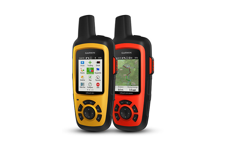
Satellite Tracker Garmin inReach
Price
550$
inReach Explorer+
650$
- Satellite Tracker Garmin inReach
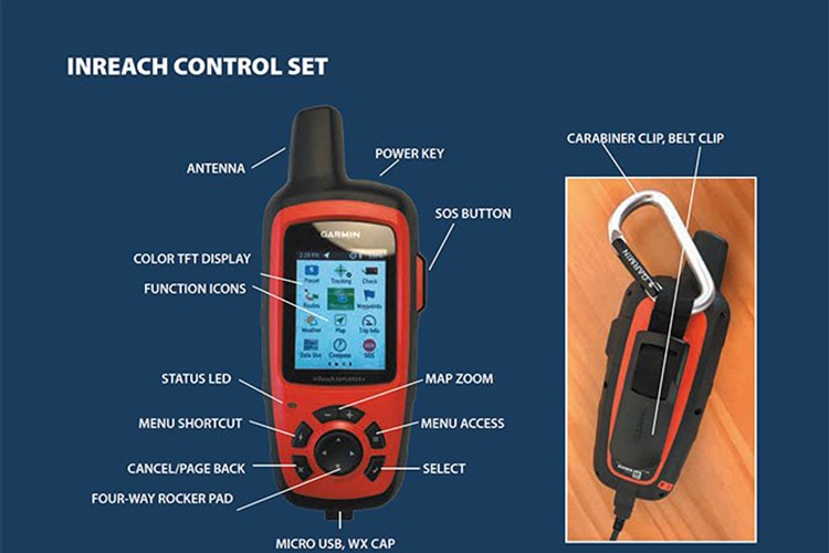
- Holder with carabiner
- USB cable
- Manual
Specifications
- 100% Earth coverage
- Battery life: up to 100 hours in tracking mode every 10 minutes; up to 30 days in tracking mode every 30 minutes.
- Configurable SOS button
- Size: 6.8 x 16.4 x 3.8 cm. Weight: 213 g
- Color TFT display, 5.9 cm diagonal.
- Bluetooth connection with smartphone for map access
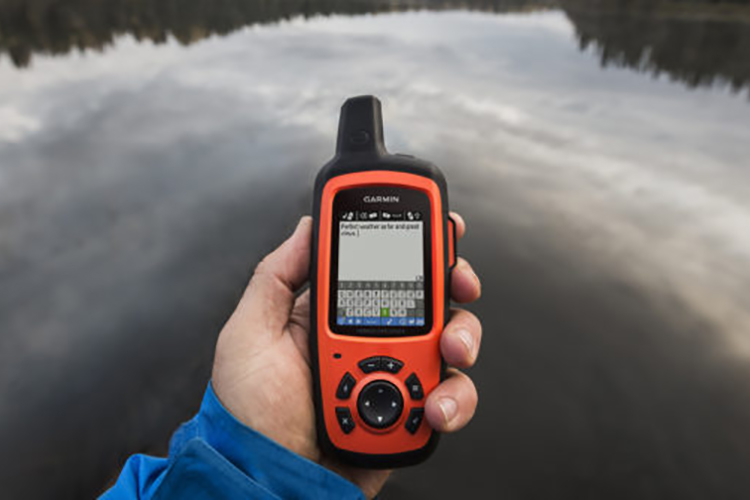
- Text message transmission and reception
- Durable waterproof case IPX7 standard
- Access to TOPO maps from tracker screen Explorer
- Additional tools: compass, barometer, altimeter and accelerometer. Explorer
- Built-in odometer for displaying useful trip statistics, such as operating time, maximum speed, average movement speed and distance traveled Explorer
Model Description
The Garmin InReach satellite tracker is ideal for outdoor activities or professional work in remote areas away from civilization. The device operates on the Iridium network, providing 100% Earth coverage from pole to pole.
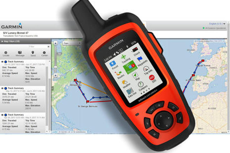
Your friends, family and colleagues will be able to exchange text messages with you and track your route and location in real-time. Data from the tracker is transmitted via the Iridium satellite network to Garmin servers and displayed in a web interface that you provide access to the necessary people. Of course, the tracker is equipped with basic GPS functions: navigation, route creation, tracks and movement along them.
The presence of an SOS button will help you get out of the most difficult situations. When the button is pressed, a distress message with your coordinates is sent to the GEOS rescue center and to your pre-entered contacts. An interactive SOS chat will help coordinate actions with the rescue service and stay in touch even in the most extreme conditions.
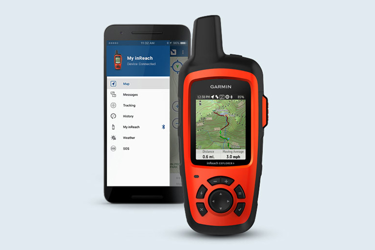
Via Bluetooth interface, you can connect your Garmin InReach to your smartphone (iOS or Android based) and use the Earthmate app to access high-quality maps, navigation and even weather data. Simply sync data from the app with your Garmin InReach. More details about the app's capabilities in the video (English).
Garmin has always been known for quality devices, and the InReach tracker is no exception - you can fully rely on it in difficult hikes and trips. High autonomy allows you to use the tracker for up to 30 days without charging (in tracking mode every 30 minutes). This makes such a device simply irreplaceable for trips outside civilized cities.
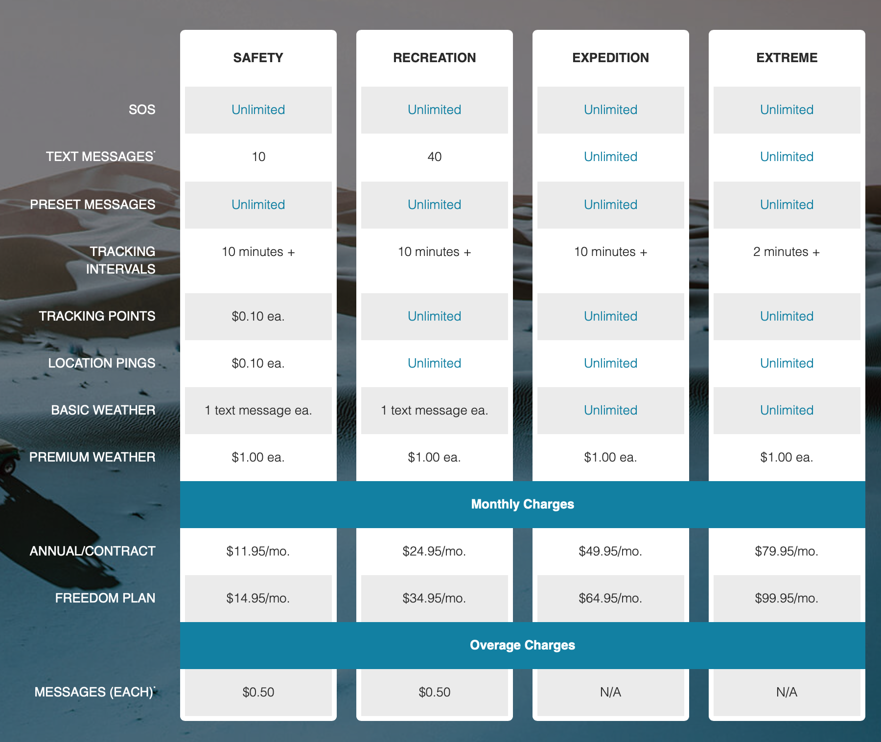
All these features are provided at very affordable rates, with options for annual or monthly subscriptions.